

 6 hours ago
1
6 hours ago
1
PROTECT YOUR DNA WITH QUANTUM TECHNOLOGY
Orgo-Life the new way to the future Advertising by AdpathwayA slow pulse of elevated Pacific water set in motion by El Niño is expected to raise sea levels along the California coast by roughly 6 inches to a foot over the coming weeks. It will not look like much. There is no breaking wave to watch, only a gradually higher waterline that tide gauges will record as the pulse moves up the coast. "It's not a wave you can surf," North Carolina State University oceanographer Dillon Amaya told the San Francisco Chronicle.
The concern is timing. Southern California beaches lost large amounts of sand to swells from former Hurricane Marie in early September, and Orange County, Laguna Beach, Dana Point and San Clemente have all declared local emergencies. A higher baseline ocean means the next big swell, king tide, or winter storm has less beach to chew through before it reaches seawalls, homes, rail lines and roads.
For homeowners on bluffs and beachfronts, the practical question is whether to inspect and repair protective structures now rather than after the first storm. The local emergency declarations are designed in part to speed exactly that kind of work.
A Wave You Cannot See or Surf
The feature is called a coastally trapped Kelvin wave. During El Niño, the trade winds along the equator weaken or reverse, pushing warm, elevated water east across the Pacific. When that energy reaches South America, it travels north along the coasts of Central America, Mexico and the U.S. West Coast at roughly 6 mph, the San Francisco Chronicle reported. The current wave raised water levels about 9 to 14 inches above the 1993 to 2025 average along Central America in late August.
Amaya has been tracking it. He told CNN that total sea level, counting the wave plus the thermal expansion of already-warm coastal water, could run 10 to 14 inches above normal along California. "The wave would add to what is already there," Amaya said. CNN reported that the coast could see about a foot of total rise by mid-October.
Amaya's estimates put the wave's arrival in San Diego in roughly the first half of October, after it traces the Gulf of California and rounds the tip of Baja California, with Los Angeles and San Francisco following within about a week. He told CBS 8 in San Diego that this is the second of what could be five or six Kelvin waves tied to this El Niño. The waves do not simply pile on top of one another, but each can keep water elevated for weeks, and similar patterns in past El Niño events kept coastal levels high into spring.
The ocean was already running high before this wave. Climate scientist Daniel Swain of University of California Agriculture and Natural Resources has said that Marie's swells arrived on top of coastal water levels that were already 6 to 12 inches above usual, the result of a pre-existing marine heat wave plus thermal expansion from El Niño.
Beaches Already Stripped by Hurricane Marie
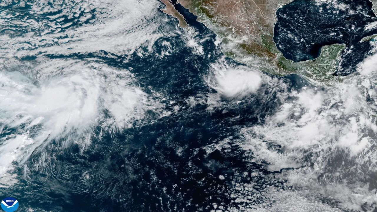
Swells from Marie, which stayed well offshore, began reaching Southern California on Sept. 2 and pulled sand off beaches from Malibu to San Clemente. In Malibu, the surf opened a sinkhole in a street and driveway along Sea Level Drive.
Laguna Beach declared a local emergency after six oceanfront homes on Ocean Way and Lagunita Drive were yellow-tagged because of compromised seawalls, and part of the Aliso Beach parking lot failed. "Most of us have never seen this much sand leave our beaches at once," City Manager Dave Kiff said, according to Voice of OC. In Dana Point, which declared its own emergency on Sept. 9, the outlet reported that nine homes had been red-tagged and seven yellow-tagged. San Clemente also declared an emergency as damage reached the coastal rail corridor through the city, and homes along the Long Beach Peninsula were damaged by pounding surf.
Orange County followed with its own emergency declaration on Sept. 17, formally requesting state and federal support to repair damage and prepare for an El Niño storm season that could begin as soon as Oct. 1, the Long Beach Current reported. Board of Supervisors Vice Chair Katrina Foley said the declaration frees up resources and streamlines permitting for cities and residents, and she urged Gov. Gavin Newsom to issue a state emergency proclamation.
It is important to separate the two events. Marie's swell did the damage. The arriving Kelvin wave did not cause that erosion, but it will raise the water level that future swells ride on.
King Tides and Winter Storms Are the Real Test
September and October typically bring some of California's lower tides, while the highest king tides arrive from November through January. That gap offers a window to prepare. Swain told KTLA the worst-case scenario would be the Kelvin wave's sea level boost, a peak king tide and a significant storm all lining up. "That would probably bring record-breaking coastal flooding this year," he said. He also warned that if several Kelvin waves arrive in quick succession, the effects of one may not fully fade before the next arrives.
The National Weather Service office in San Diego has already seen elevated water. Lead meteorologist Stefanie Sullivan told CBS 8 earlier this month that actual water levels had been running about six inches above predicted levels over the summer, and that a higher baseline raises the potential for coastal flooding during king tides around Thanksgiving and Christmas or during any high surf event.
The larger backdrop is a strong El Niño. NOAA's Climate Prediction Center gives a greater than 90% chance of a very strong event this fall and winter and a 75% chance that it reaches historic strength from October through December. El Niño tends to push the Pacific jet stream south, which tilts the odds toward a wetter winter in Southern California, though seasonal outlooks are probabilities rather than a schedule of storms.
The greatest risk falls on bluff-top homes, properties that depend on aging seawalls, low-lying streets and parking lots, beach access stairways, the San Clemente rail corridor and neighborhoods like the Long Beach Peninsula. Renters and owners in those areas face the most direct exposure, while commuters who rely on coastal rail could see service interruptions.
Uncertainty remains. Amaya has said the local rise depends partly on coastline shape and underwater features, so a given beach may see more or less than the regional estimate, and arrival dates are approximate.
Preparing Now, Before the Storm Season
Residents do not need to take emergency action because of the Kelvin wave alone. The reasonable steps are about readiness. Homeowners with seawalls or revetments should consider having them inspected now. Watch for new cracks, sinkholes, exposed footings or sand loss at the base of structures, and report damage to your city.
Sign up for your county's emergency alerts and watch for National Weather Service coastal flood advisories and high surf warnings, especially during high-tide windows. Stay off eroded bluffs and away from sand cliffs, known as scarps, which can collapse without warning. Never turn your back on the surf during large swell events.
Check your insurance before the winter storm season. Standard homeowners policies generally do not cover flood damage, and new National Flood Insurance Program policies usually carry a 30-day waiting period. Emergency declarations in Laguna Beach, Dana Point, San Clemente, and Orange County allow faster sand placement and repairs, but they do not guarantee individual financial assistance.
NOAA's Climate Prediction Center will issue its next ENSO update on Oct. 8, and tide gauges along the coast will show when the Kelvin wave arrives. The practical takeaway is simple: the ocean along California is about to sit higher than normal for weeks, perhaps months, and the time to shore up vulnerable property is before king tides and winter storms test it.
What Readers Want to Know
What is a Kelvin wave?
It is a large, slow pulse of elevated ocean water that El Niño sends along the equator and then up the coast of the Americas. It raises sea level by several inches but does not produce a visible breaking wave.
When will it reach California?
Oceanographer Dillon Amaya's estimates put it in San Diego in roughly the first half of October, with Los Angeles and San Francisco following within about a week. CNN reported the coast could see about a foot of total rise by mid-October.
Is the Kelvin wave dangerous by itself?
Not on its own. The risk comes when the higher baseline overlaps with king tides, large swells or winter storms, which can push water farther inland and speed erosion.
Which areas are most at risk?
Beaches already stripped by Hurricane Marie's swells, including parts of Malibu, Laguna Beach, Dana Point, San Clemente and the Long Beach Peninsula, along with bluff-top homes, low-lying streets and the coastal rail corridor.
When are king tides this year?
California's highest king tides typically arrive from November through January. Check NOAA tide predictions and your local National Weather Service office for exact dates.
Does homeowners insurance cover coastal flooding?
Standard homeowners policies generally do not cover flood damage. Flood coverage is sold separately, and new National Flood Insurance Program policies usually take 30 days to take effect.
Will there be more Kelvin waves?
Amaya expects this El Niño could send five or six such waves, which could keep coastal sea levels elevated through winter.
© 2026 NatureWorldNews.com All rights reserved. Do not reproduce without permission.
















 English (US) ·
  French (CA) ·