

 6 hours ago
2
6 hours ago
2
PROTECT YOUR DNA WITH QUANTUM TECHNOLOGY
Orgo-Life the new way to the future Advertising by AdpathwayTyphoon Choi-wan was still generating seas about 42 feet tall early Tuesday, even as it raced away from Japan and began losing its tropical structure. The U.S. military's Joint Typhoon Warning Center put the storm's maximum significant wave height at 42 feet at 06:00 UTC Oct. 6 (2 a.m. EDT), with a central pressure of 953 millibars, according to JTWC data compiled by Zoom Earth.
At 09:00 UTC, the center sat roughly 400 nautical miles (about 460 miles) east-southeast of Yokosuka, Japan, moving north-northeast at about 21 mph. Choi-wan never struck land. Its threat was always at sea, where its sheer size let it pile up waves across a wide stretch of the western North Pacific.
That matters well beyond Japan. JTWC expects the storm to finish converting into a powerful non-tropical low within about 36 hours, and Alaska forecasters are already tracking how its leftover energy could feed a storm in the Bering Sea later this week.
Extreme Seas Without a Landfall
Choi-wan formed north of the Mariana Islands on Sept. 30, according to the Digital Typhoon database at Japan's National Institute of Informatics. It intensified rapidly over ocean water near 86 degrees Fahrenheit. JTWC tracking data show one-minute sustained winds near 160 mph (260 km/h) at 12:00 UTC Oct. 4, with pressure bottoming near 912 millibars six hours later.
The Japan Meteorological Agency, which measures winds differently, listed Choi-wan as Typhoon No. 27. JMA reported 10-minute winds of 180 km/h (about 112 mph) and a pressure of 965 hectopascals at noon Japan time Oct. 3, as the storm moved over the Marianas toward waters near the Ogasawara Islands, The Star reported.
Yale Climate Connections reported that JTWC's initial analyses placed the peak at 135 knots, just below Category 5 strength, before a retrospective JTWC review indicated the storm briefly reached Category 5. Final intensity figures may change again in post-season reanalysis.
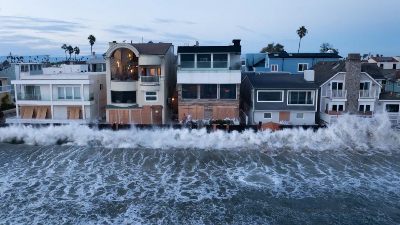
A storm can build enormous seas without making landfall because waves grow from three ingredients: wind speed, how long the wind blows, and the distance of open water it blows across, known as fetch. Choi-wan scored high on all three. Its slow movement early in its life and its very large wind field gave waves time and space to grow.
Meteorologist Ryan Maue noted the contrast with a nearby storm in his Weather Trader tropical update. "Nolo looks tiny compared to Choi-Wan, which has an enormous wind field," Maue wrote.
Risk Along North Pacific Shipping Lanes
Significant wave height is not the tallest wave. By the standard oceanographic definition, it is the average height of the highest one-third of waves. Individual waves in the same sea state can occasionally reach roughly twice that height, which is why mariners treat a 40-foot significant wave height as a serious hazard even for large cargo ships.
The private forecaster Weathernews warned early in the storm's life that Choi-wan would bring expanding wind hazards across Western Pacific shipping corridors, projecting a storm-force wind area stretching up to 280 nautical miles from the center by Oct. 6. That footprint covered waters used by vessels moving between East Asia, Guam and North America.
Vessels in the region typically reroute or slow down to avoid the worst quadrant of a storm like this. That can delay arrivals at ports in Japan and along the U.S. West Coast, though no specific shipping disruptions or vessel incidents tied to Choi-wan had been confirmed by official sources as of Tuesday morning.
Closer to the storm's early track, the Northern Mariana Islands felt direct effects. Saipan and Tinian received an all-clear on Sunday, Oct. 4, local time, while the sparsely populated northern islands of Pagan, Agrihan and Alamagan remained under a typhoon warning at that time, RNZ reported. Readers there should follow the National Weather Service office in Guam for current conditions.
Alaska Watches the Storm's Second Life
JTWC's latest forecast reasoning, posted at 09:00 UTC Oct. 6, calls for Choi-wan to cross into water cooler than 79 degrees Fahrenheit within 12 hours and to complete extratropical transition within 36 hours. The agency said the system should still produce typhoon-force winds through that period and that its wind field will stay large, with very high seas. Track guidance is tightly clustered, giving forecasters high confidence in the path.
In Alaska, Alaska's News Source meteorologist Aaron Morrison said a low building near the Kamchatka Peninsula is expected to merge with the typhoon's remnants later this week. Morrison said the combined storm could bring high winds, heavy rain, rough seas and elevated water levels as it moves east through the Bering Sea, along with a prolonged period of gusty winds for the Aleutians. He also reported that high surf advisories had been issued for later this week along Western Alaska's coast.
Maue wrote that the storm could re-intensify into a very powerful system approaching Alaska. That is a possibility, not a forecast of a specific coastal impact. Exact wind speeds, surf heights and timing for Alaska communities will come from the National Weather Service offices in Anchorage and Fairbanks, not from typhoon tracking products.
Alaska has seen this pattern before. Former typhoons that merge with North Pacific lows can re-strengthen over the Bering Sea, and the remnants of Typhoon Merbok in 2022 became one of the strongest September storms on record for Western Alaska. Whether Choi-wan's remnants reach anything like that strength is not yet known.
Preparing for High Surf and Rough Seas
The greatest risk now falls on mariners, commercial fishing crews and coastal communities in the Aleutians and Western Alaska, where storm-driven water can flood low-lying roads, erode shorelines and damage boats in exposed harbors. Residents of Japan's Pacific coast should follow JMA for any lingering swell advisories.
Watch for official coastal flood watches or warnings, high wind warnings and high surf advisories from NWS Alaska offices. A sudden rise of water near homes, fuel tanks or boat harbors, or a wind shift to strong westerly flow, are signs to act on local guidance immediately. Call 911 if water threatens your home.
Reasonable steps now include securing boats and gear, moving fuel and equipment away from the shoreline, charging phones and backup batteries, and checking on elders who rely on electric medical equipment. Do not walk on exposed shorelines or jetties during high surf.
Commercial operators should follow U.S. Coast Guard and NOAA Ocean Prediction Center marine warnings. Small-boat operators in Western Alaska may face several days of hazardous conditions, which can delay fuel and supply deliveries to remote villages that depend on barges.
JTWC will continue issuing warnings until the transition is complete, after which marine and coastal forecasts pass fully to NOAA and NWS Alaska. The next key update for Alaska readers will be the NWS forecast discussions issued Tuesday and Wednesday.
The bottom line is that Choi-wan's most dangerous phase for people was always at sea, and it is not quite over. Its seas remain extreme over open water, and its remnants could still shape a stormy end to the week in Alaska. Readers should rely on NWS Alaska and their local emergency managers rather than viral storm graphics.
Developing Story Timeline
Oct. 6, 2026, 09:00 UTC: JTWC forecasts full extratropical transition within 36 hours; Alaska forecasters track a merger with a Kamchatka low.
Oct. 6, 2026, 06:00 UTC: JTWC lists maximum significant wave height at 42 feet and pressure at 953 millibars.
Oct. 4, 2026, 12:00 UTC: JTWC tracking data show peak one-minute winds near 160 mph.
Oct. 3, 2026, noon Japan time: JMA reports Typhoon No. 27 at 965 hectopascals over the Marianas.
Sept. 30, 2026, 18:00 UTC: Choi-wan forms north of the Mariana Islands.
What Readers Want to Know
Did Typhoon Choi-wan make landfall?
No. Choi-wan stayed over open ocean, passing near Japan's Ogasawara Islands before turning northeast into the North Pacific. Its main hazards were extreme seas and strong winds over water.
How tall were Choi-wan's waves?
JTWC listed the maximum significant wave height at 42 feet at 06:00 UTC Oct. 6. Significant wave height is the average of the highest third of waves, so occasional individual waves can be taller.
Was Choi-wan a Category 5?
JTWC's real-time analysis put the peak at 135 knots, just under Category 5, but a later JTWC review indicated it briefly reached Category 5 strength. Final figures may change after reanalysis.
Will Choi-wan affect Alaska?
Forecasters expect its remnants to merge with a low near Kamchatka later this week, which could bring high winds, rough seas and elevated water levels to the Aleutians and Western Alaska. Follow NWS Anchorage and Fairbanks for official alerts.
Who faces the greatest risk now?
Mariners, commercial fishing crews and residents of low-lying coastal communities in the Aleutians and Western Alaska face the most direct risk from high surf and coastal flooding.
Does Choi-wan threaten the U.S. West Coast?
No official forecast shows direct impacts to the West Coast. Long-period swell or shipping delays are possible, but none had been confirmed as of Oct. 6.
© 2026 NatureWorldNews.com All rights reserved. Do not reproduce without permission.



















 English (US) ·
  French (CA) ·