
PROTECT YOUR DNA WITH QUANTUM TECHNOLOGY
Orgo-Life the new way to the future Advertising by Adpathway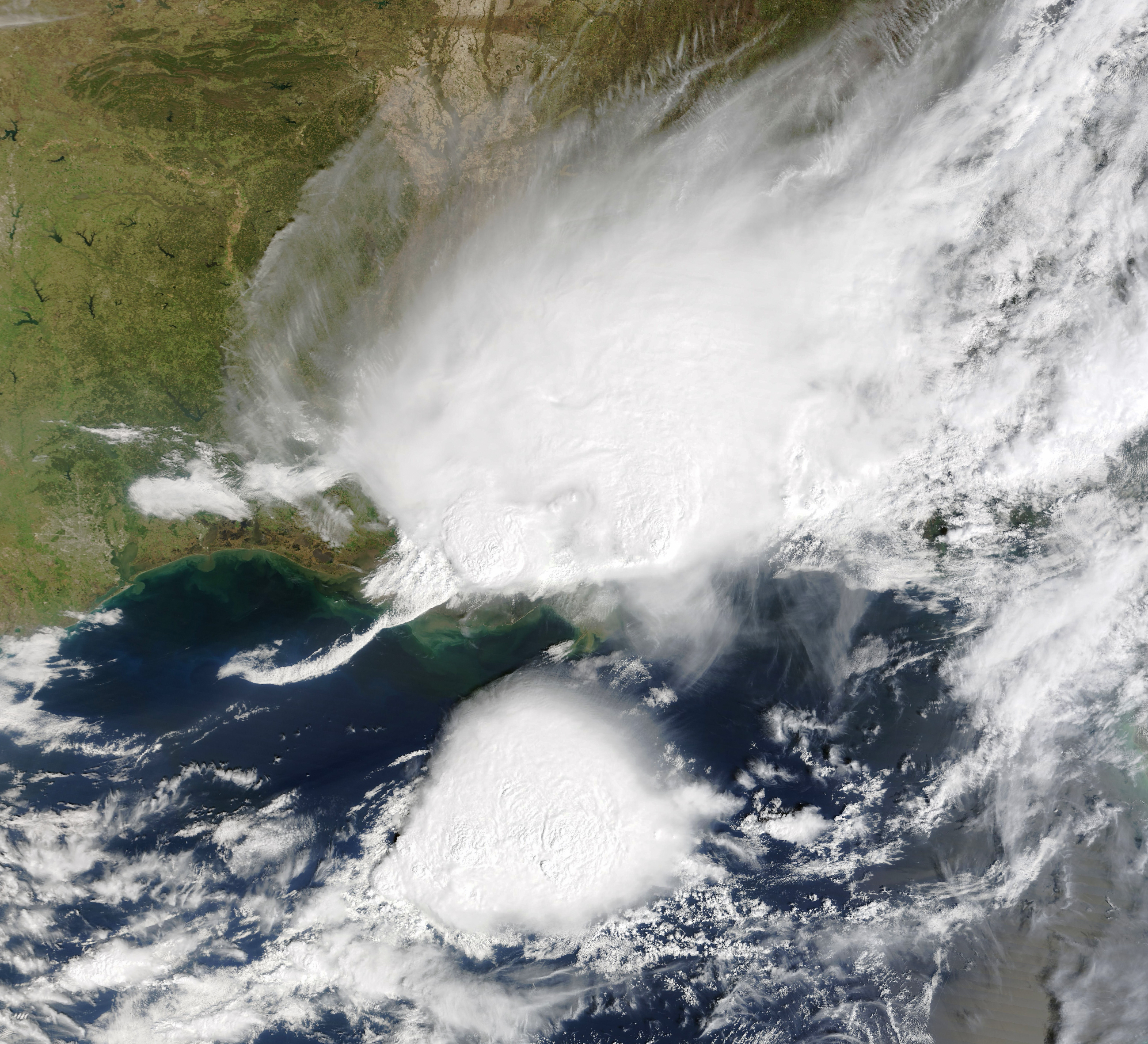
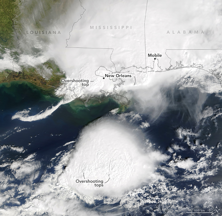
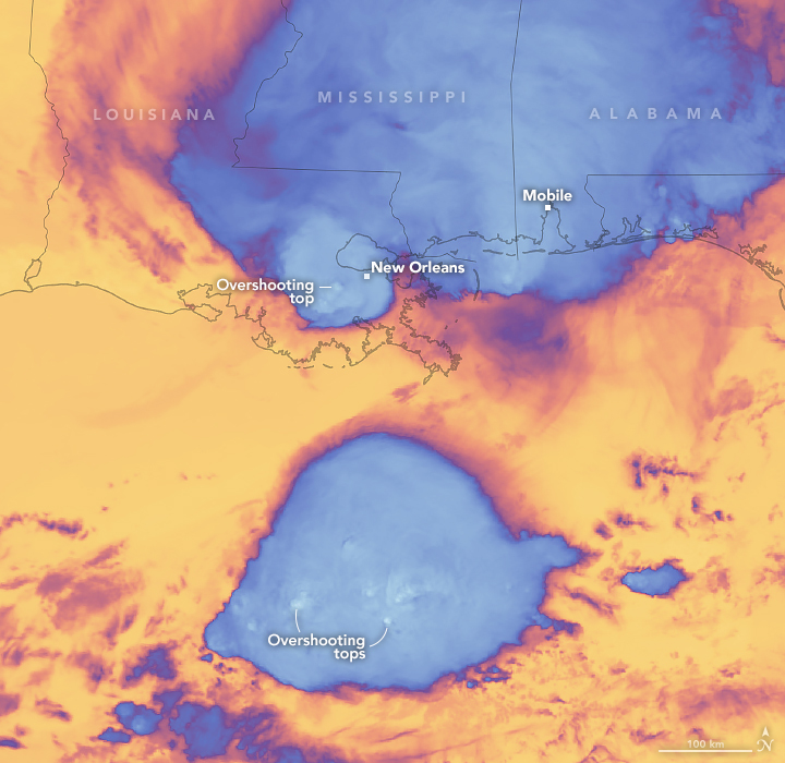
On the morning of March 24, 2025, a relatively fast-moving line of thunderstorms stretched across the parts of the U.S. Gulf Coast. These satellite images show the region at around 10:30 a.m. Central Time (15:30 Universal Time) as storms threatened southeastern Louisiana and areas east toward the Florida Panhandle.
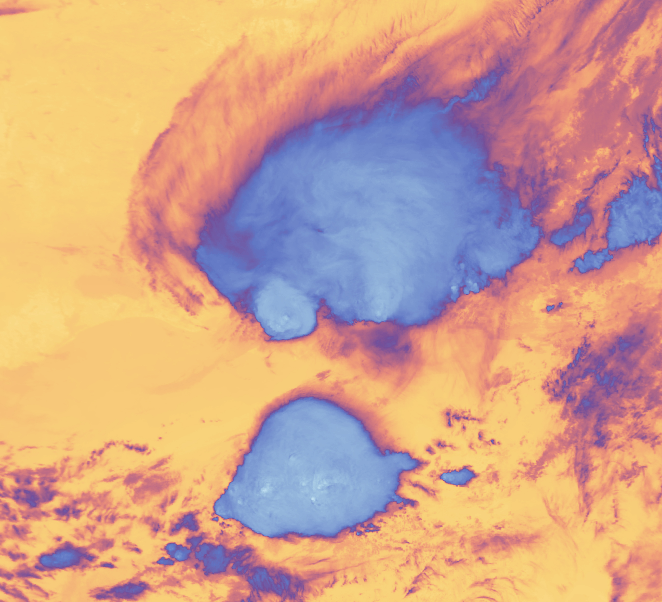
The dome-like protrusions, or overshooting tops, visible in the image are one indication of the storm’s severity, according to Kristopher Bedka, an atmospheric scientist at NASA’s Langley Research Center. These thunderstorm updrafts, which penetrate the top of the surrounding anvil cloud, are often associated with lightning, hail, tornadoes, and damaging winds.
Some of this cloud structure is visible in the natural-color image (left). But the overshooting tops become even more apparent in the false-color image (band 31) of the region’s brightness temperature (right). Having punched through and risen above the anvil cloud, the tops of these updrafts are cooler (whiter) than the surrounding cloud surfaces. Both images were acquired with the MODIS (Moderate Resolution Imaging Spectroradiometer) on NASA’s Terra satellite.
Bedka noted that the storm over Louisiana was a small, isolated severe storm cell. In contrast, the larger storm complex to the south, which displayed numerous overshooting tops, appeared to be a mesoscale convective system.
Around the time of these images, the Storm Prediction Center reported severe hail (at least one inch in diameter) in Terrebonne Parish in southern Louisiana. Hailstones measuring up to 1.25 inches (half-dollar size) were observed in parts of the parish. The same report noted that toward the north in East Baton Rouge, a surface weather station recorded a wind gust of 78 miles (126 kilometers) per hour, and downed trees and power lines were reported across several parishes.
While thunderstorms over land are generally the most intense in the afternoon and evening hours, this is the time of year when morning storms are more likely. “In winter and early spring, strong atmospheric lift associated with fronts and mid-latitude cyclones can trigger storms in the morning,” Bedka said. “We usually do not see these fronts and cyclones in summer.”
NASA Earth Observatory images by Michala Garrison, using MODIS data from NASA EOSDIS LANCE and GIBS/Worldview. Text by Kathryn Hansen.


 English (US) ·
  French (CA) ·