
PROTECT YOUR DNA WITH QUANTUM TECHNOLOGY
Orgo-Life the new way to the future Advertising by Adpathway
11 PM
Erin moving WNW as per NHC
Slower at 14 MPH
140 MPH sustained winds.
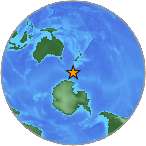
20.3 N 65.1 W
Note the disclaimer that hazardous conditions can occur outside the Cone. What does that mean in this case? Let's say the center of Erin stays offshore of OBX at a safe distance, it does not mean that there will be large waves, beach erosion and possible problems with Highway 12 a narrow ribbon of a road that's beautiful to drive but where even in mild windy conditions sand from the dunes blows across the road and often a hurricane will wash it out for a while even when the center of the storm stays offshore. Not saying this will happen it is merely an example. And, all along the parts of the coast where the waves will be high people will drown at some beach somewhere sadly. So remember the NHC is tracking the "probable path of the storm" and again it's not carved in stone, updated every six hours.

Earliest reasonable arrival time of TS winds.
As of 11 PM.
Wind probs that change every 6 hours.
Remember some are VERY LOW.
It's good to keep an eye on.
Emergency management needs to...
...so you do to.

To the North
To the South

It's got a long way to go...
...this will narrow down.
As I show at the end.
Models d o begin to diverge.
Small storms grow big...
..at Northern latitudes.
From discussion.
Going thru eye wall replacement cycles.
Eye is wobbling a bit trochoidal motion. (Google it)
Discussion mentions the size of the storm and I wrote about that at great length below an hour earlier (down below) while waiting for the 11PM discussion to come out. Glad they mentioned it as it's officially a question vs me musing meteorologically my thoughts.

The hurricane that will become a larger storm will eventually find the weakness in the high. Note despite the many wind probabilities I showed they did not show Miami or Key West
Future intenisities hard to nail down but they do their best job. She will grow in size once she climbs in latitudes they always do. And, while her center is forecast to stay North of some islands storms in her bands can cause flooding, landslides, mudslides and the Bahamas should watch and monitor her. Distant thunderstorms in bands can be strong and so pay attention.

Most likely she has peaked.
But personally expect surprises.
Time will tell.
Excellent discussion.

So that is the 11 PM update. My thoughts are below and written about an hour ago adding in some images from X that I felt were excellent and told the story well.
Again there is just only so much multitasking a small hurricane can do while going through Rapid Intensification in a 24 hour period to a Cat 5 and doing meteorological eye wall acrobatics known as eye wall replacement cycles.
Please keep reading my thoughts on how hard it is to forecast what a small storm will do and also all the intangibles. I really did not believe she would turn WNW to NW fast though I understood the logic based on the models. I wasn't going to say that as it's not the forecast, though I imply and suggest much on X. I did say there would be wrinkles and the wrinkle today was westbound the whole day and we are still not sure on actual movement yet as the eye is wobbling, but that is the forecast above.
Enjoy my thoughts and I'll update tomorrow on Sunday after way better information comes in and better models and good satellite imagery and we see what Erin really wants to do.

I am not ignoring the rest of the tropics I'll discuss it Sunday ... but there's another storm that most likely will form in Erin's wake so keep on tracking and don't eat the hurricane supplies just yet, wait til after Halloween at least! 2025 forecast to be a wild backloaded hurricane season.

So I was watching NASCAR this evening and looked up from looping Erin moving West and I saw this scene. Went back, rewound... "wait did that really happen" "where did that tire come from" and while I knew it was still a crazy scene to see in real time happen. I feel the same way about Erin. I'm offline on Saturdays tho I did hear that Erin was going West and while I was not surprised I did wonder how long the Westward Movement... would continue.

Let's go back to Friday afternoon to decipher today
There's this large red FENCE
Saying "BEWARE DON'T GO HERE!"
Erin was coming together.
Again image above was Friday.
A little while later we saw this...

Gorgeous graphic for a heart.
This was a hurricane about to strengthen.
They do strange things before they do that.
They look like crap or wall art.
Then they pull it together.
The forecast for Erin was for her to pull it together, rapidly intensify and pull to the WNW away from the Islands all at the same time. And, she out performed their wildest expectations of Rapid Intensification going from 75 to 85 to OMG 160 MPH. But the wrinkle that I said could happen is that rather than do this while making a forecast curve away from the Islands is she went West not WNW all day long nor did she go NW. Finally the NHC had to acknowledge it wasn't a random wobble and she was moving West so they adjusted the forecast a bit to the West tho not wanting to change the overall forecast track waiting for her start to lift a bit in latitude. They have to adjust a track between various model out put (and oh my goodness there's so many in 2025) and do the best job they can to inform us of what the storm is going to do. It's not an easy job. Appreciate all they do please!
And, Mother Nature is want to pull surprises especially in a year such as 2025 that has had many wild surprises. There's many laps for Erin to go for the NHC. There are only 22 laps to go in the NASCAR race I'm watching as I type this and there's many parralels.
You have a driver who is the best driver and the best car and knows the track but there's other variables and intangibles from crashes to a wheel coming off. Suddenly something changed. So let's fast forward to the same satellite as yesterday to tonight.

Whoah what a different now!
Note the "core" is to the N of PR.
PR is getting impacts obviously.
This image doesn't show details.
It's just colorful and I know what it shows.

PR got lashed by the southern band.
The strong tail of Erin.
The dark black ball to the top is the core.
The larger purple swirling dots the pocket.
Let me list a few things I want to say below while waiting for the 11 PM forecast that I'll post at the top as soon as they hit the button to send.
Models do worse with small core systems historically. Sometimes they are good other times they miss things.
Rapid Intensificaiton takes a lot out of the storm while it strengthens and there's a limit to what else can happen. It's as if time stands still during eye wall replacement cycles.
The basic track of the storm that will include a curve up into the Atlantic will play out but there have been some revisions to the script. A lot of running room between PR and Florida, less between Cuba and PR as anyone who went through Irma will tell you.
A weakness will open up in the Atlantic, but when and where is now to be determined and the NHC is doing the best they can to share that info with you and inform you of where the storm is going. Back in the 1800s when many a late Summer hurricane slammed into some barrier island it washed most of the residents of all ages out to sea to watery graves with only a few survivors moving far inland to tell the tale. So yes sometimes there's a wrinkle in the forecast and it gets resolved in real time and the NHC does a bang up job at adjusting and trying to give us the best information they can give. Models have not been stellar in my opinion this year and the NHC does rely on models guidance though sometimes they adjust to the left or right based on their own logic.
Maybe you are a great multitasker but not every hurricane is and not every hurricane can pull it together, intensify in one day from 85 MPH to 160 MPH and decide to pull to the right and bust through a ridge and well no Erin isn't that kind of multitasker. Hurricanes often slow before making a turn. Hurricanes often continue movement in a kinetic energy way carrying a high aloft and reinforcing their current movement in a way a Cat 1 or Cat 2 cannot do and I have seen this over and over. Again readers of my blog know I use Hurricane Georges as an example of continuing steady movement despite the NHC insisting on every advisory it would begin to make the turn soon. It did not, tho eventually it did turn to the North as most hurricanes seek out the Poles, in our case the North Pole.

Excellent image above in a good post.
Look at that strength.
Perfection.
Erin.
So my last thought is this.......
There were too many expectations, especially considering her small size, and Erin went West while doing her epic rapid intensification and exploding. Expecting more from her would be akin to telling a woman in labor doing Natural Childbirth to hand you a coke and ask her if she can WhatsApp your sister to let her know you are having the baby now and as soon as the baby pops could she wash up the dishes a bit and send out baby announcements. Nah........that's not happening and if you have ever had a baby naturally or seen a baby coming out of the womb while the mother is pushing and concentrating to think she's going to do anything else but keep pushing you've got way too high expectations. Erin pushed into a beast, but still she's a small beast. And, in ways she is still a baby because who knows what else she will do to dazzle and surprise us as she has a long ways to go before it's over. And, a storm forming behind her and that little yellow area and the fronts and the break in the high if and when and where that happens and well... there's only so much she can do while going through eye wall replacement cycles and or intensifying.
As for the models....

Models will go in every direction from this point.
She's further West and still low.
Still doing her eye wall replacement cycles.
Most likely...
Carolinas need to watch carefully.
OBX can get impacts.
She turns fast out to sea.
She turns slower...
Long Island.
Anywhere land just out there.
But for now watch.
In Miami watch.
In Savannah watch.
In Charleston watch.
In Pawleys Island watch!
In Wrightsville Beach WATCH!
Until a Hurricane is way N of you...
WATCH IT CAREFULLY
That's what my Momma said!
Til it's way to your North you watch it!
And every update from the NHC!


 English (US) ·
  French (CA) ·