
 2 years ago
355
2 years ago
355
PROTECT YOUR DNA WITH QUANTUM TECHNOLOGY
Orgo-Life the new way to the future Advertising by AdpathwayThe flat ground of Lakeside Park (and also the Clinton neighborhood) is an unusual landform for Oakland and the East Bay in general: it’s a terrace made of gravelly sand and clay that was deposited around 125,000 years ago, a time when the sea level was several meters higher than today. I’ve featured it in previous posts, but today I’ll go farther afield, because the things we know in geology are based on more than just looking at what’s in front of us.
The formal description of this terrace, mapped as unit Qmt, marine terrace deposits, in the geologic map, includes this: “Similar terraces are located north of the map area on the south shore of San Pablo Bay in the extreme northwest Contra Costa County at Lone Tree Point, Wilson Point, and an unnamed outcrop in between. The oyster beds at the base of these outcrops unconformably overlie the Cierbo Sandstone of Miocene age and are in turn overlain by about 5 m of greenish-gray silty mudstone. The oysters have been dated by the uranium-thorium method and are of last interglacial age, approximately 125 ka.” So last week I made a road trip to see these terraces. I also looked into the literature. Both had mixed results.
Unless you live in the Pinole-to-Rodeo corridor, you’ve probably never heard of Wilson Point and Lone Tree Point. Here they are on the 1949 topo map, when the area was much less crowded. Hercules was still a company town, organized around the dynamite works there. (Now the area is being paved with over-the-top condo/townhome developments.)
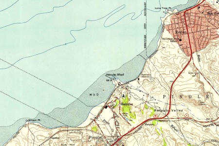
These days the Bay Trail offers access to most of that stretch of coastline.
I’ve always been curious about these little bits of land along the coast because the Capitol Corridor trains go past them at a relatively slow speed. Wilson Point is on the other side of the tracks, which are fenced off. I must advise you not to cross them.

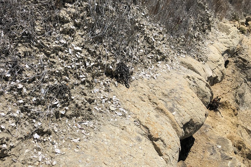
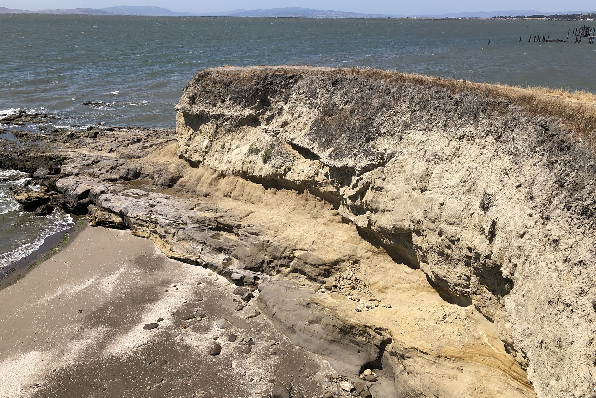
However, if you choose to ignore my advice, take the trail through the gap in the fence and carefully approach the point. This view shows the underlying rocks, with their tilted beds, and the small remnant of the terrace deposits on top. The difference in angles between the two layers is what “unconformably” refers to in the description.
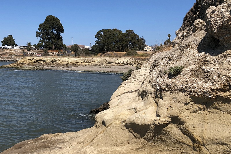
Here’s the contact between the rock and the terrace deposits. The original source of the description I quoted above (USGS Open-File Report 93-286) clarifies that between the tilted bedrock and the shells is a layer of estuarine mud, the kind of muck you’ll find in a bayside marsh today. And behold, here’s a fine layer of consolidated mud topped by a fine layer of shells. These are the shells that were dated as 125,000 years old.
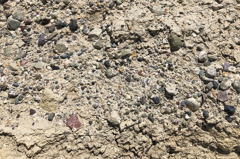
And above them is this hard gravel cemented with clayey silt. It is very much like the gravel at Lake Merritt: the particles are the same size, rounded to the same extent and similar in the variety of rock types represented in the pebbles.
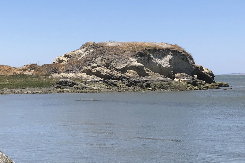
So this is the evidence used to decide that Oakland’s terraces date from the last major interglacial. Now let’s look at Lone Tree Point, up in Rodeo. When you’re riding the train, it’s where you pass this wrecked boat. Note that the old pier on the left is resting on bedrock.
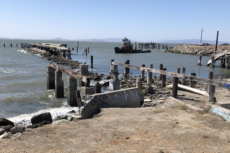
The train tracks punch through the waist of Lone Tree Point, and a bridge leads over the tracks. You can see those details in this photo. I advise you to take that bridge, which gets you onto the land at the south end where the marine terrace is, which is owned by the East Bay Regional Parks District.
Note the area of rock in the middle. That’s where I took the next photo.
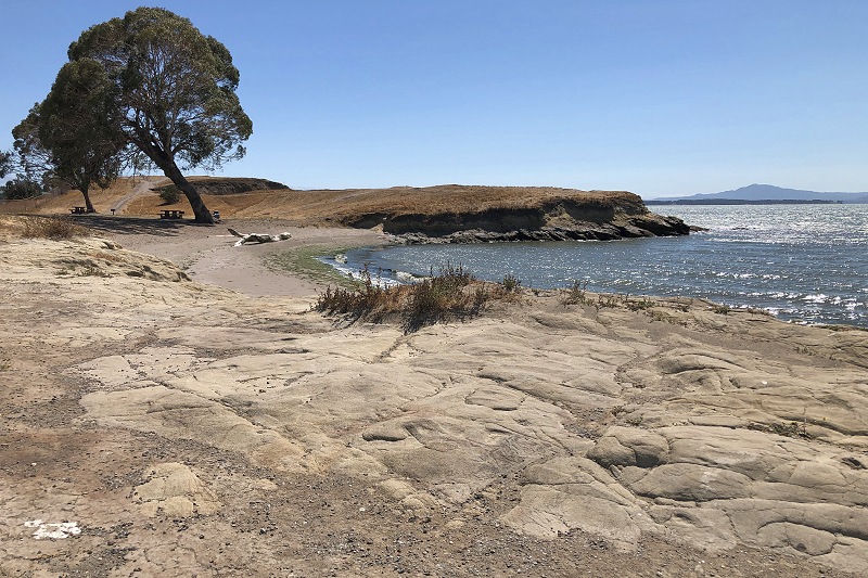
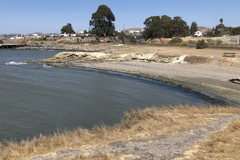
This rock pavement is the hardened ancient Bay mud that was laid down on the surface of tilted rock beds. The terrace behind it preserves it all: bedrock, mud, shells, gravel.
Here’s a more detailed view; click to view its full 1200-pixel splendor.
The story goes like this: in cold glacial times the waves cut a wide flat surface across the tilted bedrock, the kind you’ll see active today along the Pacific coast of San Mateo County. Then the glaciers melted, even much of the Greenland and West Antarctic ice caps, and sea level quickly rose upward several meters higher than today, it was that warm. The bare rock platform collected a coat of Bay mud. Meanwhile streams got busy in the warm, wet climate, and washed huge amounts of gravel down from the hills into the bay, building thick deposits up to the waterline and perhaps above it. The shells got ripped up, tumbled around and somehow laid down first; I’m not clear on just how, but the shells clearly are not lying where they lived. Then the glaciers came back with a vengeance, the sea was drawn down more than a hundred meters, and the terraces were left high and dry and prone to erosion. Only little bits of them are left, especially now that the sea is high again (and rising) and attacking the entire California shoreline.
Now, in the Oakland terraces only the gravel part is visible. Assuming that there’s a shell layer and mud layer and a wave-cut platform beneath the gravel, those must exist a little below sea level. I don’t think we know; I’m not aware of any borehole records from Oakland’s terrace, although there must be some. But the same authors who documented these terraces on San Pablo Bay reported that shells of the same age have been found as deep as 40 meters below sea level in the South Bay.
The implication is that the whole southern part of the San Francisco Bay basin has been sinking while San Pablo Bay has pretty much stayed where it is. That’s what geologists do with a few data points: they make up a plausible story and see if any new evidence fits it. Oakland’s terrace appears to lie between those two levels, so the evidence, such as it is, fits.
I’m skeptical, frankly. The initial layer of mud is said to be 4 meters thick. That’s not true at Wilson Point, and that’s stretching it at Lone Tree Point. Also, the supposed “oyster beds” are a shell hash, not present in all outcrops, in which real oysters appear to be uncommon. Sometimes this happens when you check everything out on the ground.
This entry was posted on 19 July 2021 at 8:01 am and is filed under Oakland sediment and soil. You can follow any responses to this entry through the RSS 2.0 feed. You can skip to the end and leave a response. Pinging is currently not allowed.


 English (US) ·
  French (CA) ·