
 4 months ago
99
4 months ago
99
PROTECT YOUR DNA WITH QUANTUM TECHNOLOGY
Orgo-Life the new way to the future Advertising by AdpathwayDisclaimer: This site is not affiliated with the National Hurricane Center, Hurricane Hunters, Storm Prediction Center, or National Weather Service. ALL forecasts herein are the result of my analysis, and I am solely responsible for the content. As ALWAYS, follow the National Hurricane Center, National Weather Service, and your local Emergency Management officials for emergency decisions. In addition, this is strictly a FORECAST OFFICE. I CANNOT make decisions regarding travel plans, etc. My purpose, is to provide you the information, based solely on information I analyze, and the accuracy of the information at hand of the time of analysis, so you may make informed decisions.
(T. F. “Storm” Walsh)
For those who have donated to my site, your help has been greatly appreciated. If you are not aware, donations to my site help pay for subscriptions to sites I use as well as software updates, which provide all the models and information used in my forecasts. To donate, please click the DONATE button to the right side of the page, or on the graphic of the dog. Any help you provide is immensely appreciated!
DONATIONS NEEDED AND APPRECIATED


I will reiterate, my forecasts are based on the available information at the time of analysis, and are only as accurate as the information analyzed and the solutions provided.
Greetings all!
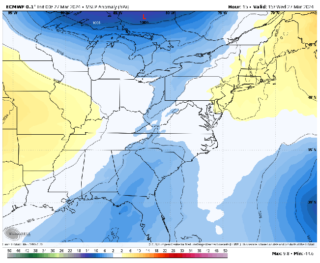
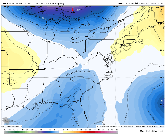
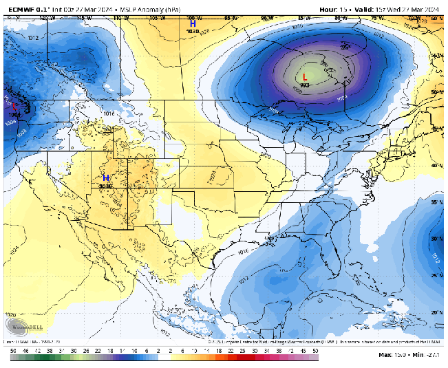
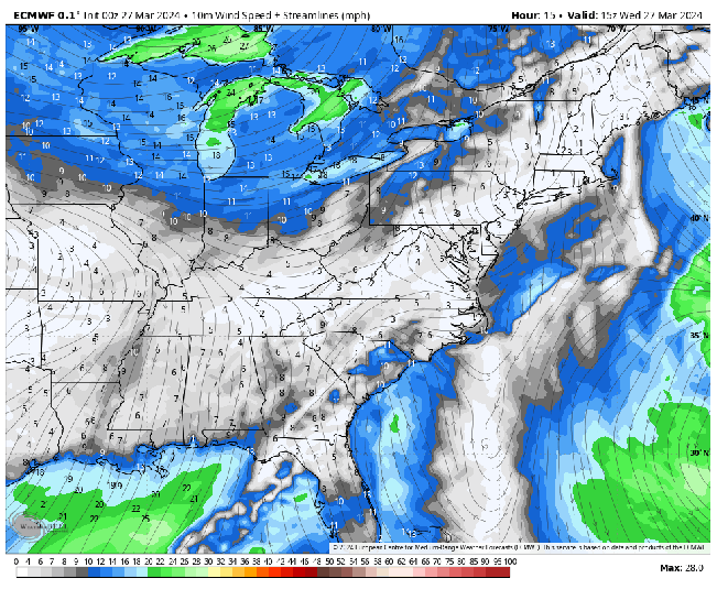
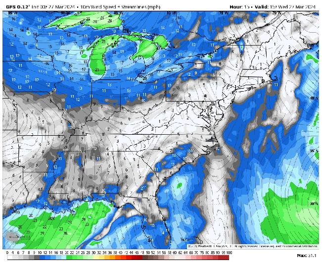
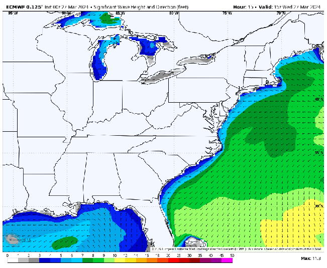
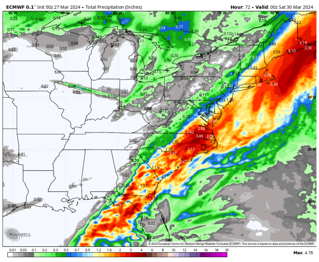
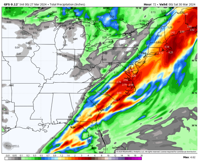
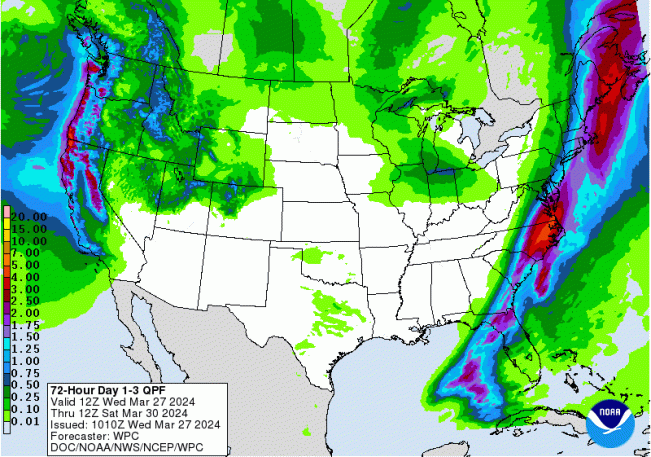
Based on my analysis of the ECMWF, and GFS models, an area of lower pressure currently affecting the Florida panhandle area is forecast to emerge near the OBX and begin developing into a brief coastal storm, and moving NEWD and affecting the offshore areas, eventually moving into and affecting the Gulf of Maine. Based on the origin of the low, it would be considered a “Miller type A”. In fact, looking at the extended forecast, a series of lows supposedly make their way across the U.S., and splitting as they near the eastern U.S. and Canada, with new low centers developing over or near the Gulf of Maine. These lows could also set the stage for severe weather over various portions of the U.S. over the next week or two. The current forecast low is progged to strengthen to 28.91 in. over the Gulf of Maine by late Friday evening. Initially, surface winds near the coastal areas of the OBX could be 25 – 30 mph, with winds increasing offshore to gale force. Waves close to the coast could reach 6 – 10 ft, with waves reaching 18 – 20 ft offshore. Small craft should remain in port, and residents should not venture near the water. Areas affected by the onshore wind flow could experience coastal flooding due to the combination of wave action and precipitation.
ECMWF AND GFS MSLP ANOMALY FORECAST
ECMWF EXTENDED
ECMWF AND GFS SURFACE WIND FORECAST
ECMWF FORECAST SIGNIFICANT WAVE HEIGHTS
ECMWF AND GFS 72 HOUR FORECAST PRECIPITATION TOTALS
WPC 3 DAY RAINFALL FORECAST
The following NWS Watch / Warning map will provide local NWS information for your area. Click the image, then once it refreshes, click on your area of interest to view any special weather statements, hazards or advisories for your area.
NWS WATCH / WARNING DISPLAY (LINKED…CLICK MAP, THEN YOUR AREA)

NWS DOPPLER RADAR LOOP (LINKED, CLICK RADAR MAP)

RAP RADAR (CLICK IMAGE THEN GO TO LOOP DURATION AND PICK LENGTH OF LOOP, THEN CLICK RADAR SITE)
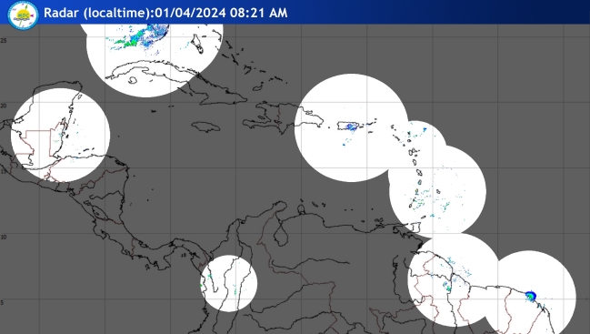
CARIBBEAN RADAR (CLICK IMAGE)
You may direct any questions by contacting me personally, ANYTIME, at: [email protected]
Have a blessed day!
T. F. “STORM” WALSH III
GMCS, USCG (ret)
METEOROLOGIST / HURRICANE SPECIALIST /SEVERE WEATHER SPECIALIST

This entry was posted in Tropical Synopsis. Bookmark the permalink.


.gif)


 English (US) ·
  French (CA) ·