

 3 hours ago
11
3 hours ago
11
PROTECT YOUR DNA WITH QUANTUM TECHNOLOGY
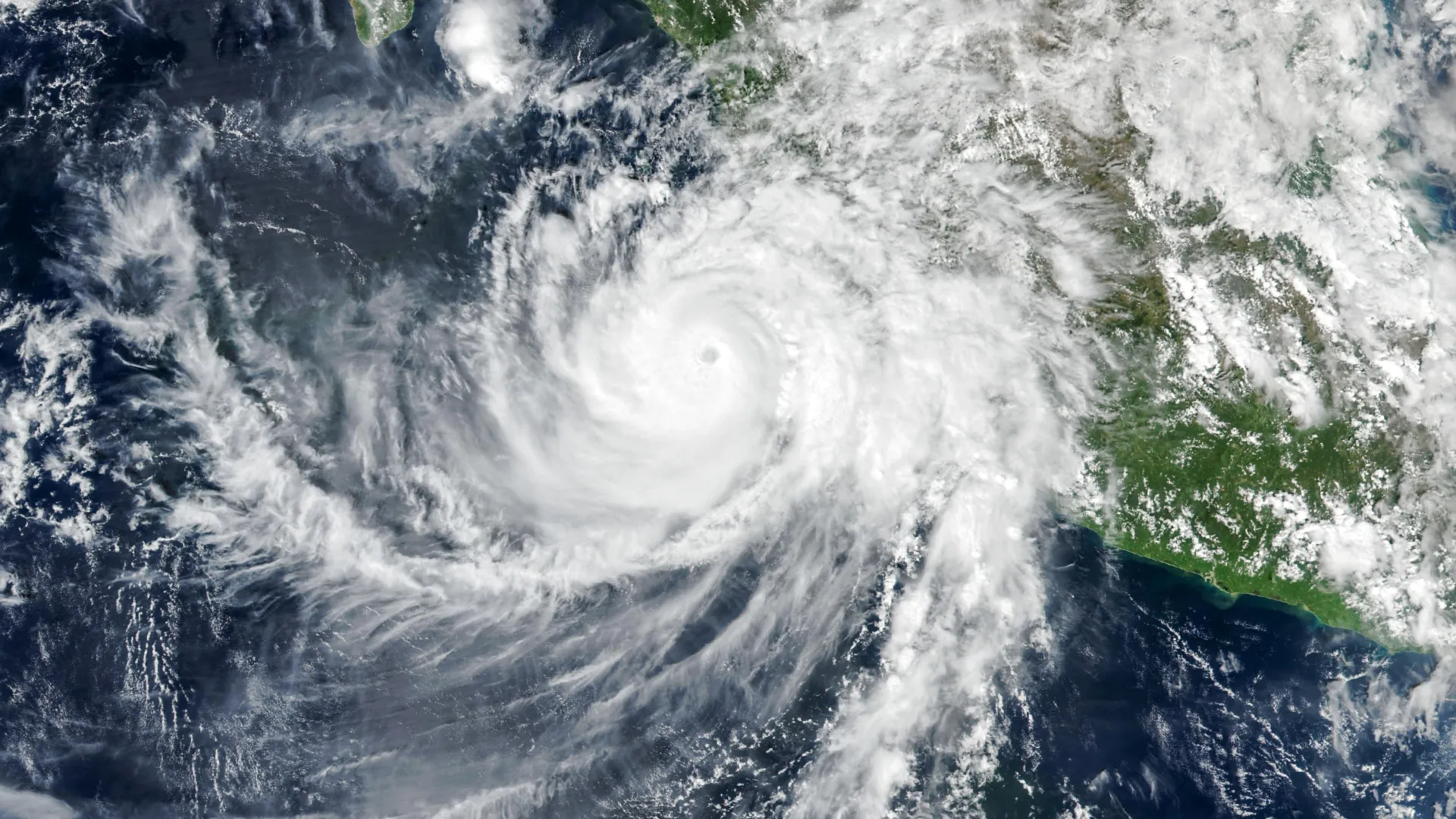
Orgo-Life the new way to the future Advertising by AdpathwayMexico extended a Hurricane Watch north to Cabo Corrientes on Thursday night as Hurricane Trudy strengthened to 105 mph (165 km/h) winds off the country's southwestern coast. In its 9 p.m. CST advisory on Oct. 15, the U.S. National Hurricane Center said Trudy was expected to rapidly intensify into a major hurricane on Friday.
Trudy is the third tropical system in about a week to threaten Mexico's Pacific side. Hurricane Simon brushed the Colima and Jalisco coast as a Category 4 storm on Oct. 11, and the remnants of Tropical Storm Rachel caused deadly flooding farther north in Baja California, leaving at least six people dead as of Oct. 13, according to the Associated Press.
That sequence changes the practical risk. Rain falling on hillsides and rivers that are already saturated can trigger flooding and mudslides faster, and communities still cleaning up from Simon may have weakened roofs, blocked drainage and damaged roads heading into another storm.
Watches and Warnings as of Thursday Night
At 9 p.m. CST, Trudy's center was about 230 miles (375 kilometers) southwest of Acapulco and 355 miles (570 kilometers) south-southeast of Manzanillo, moving north-northwest at 7 mph (11 km/h). Its minimum central pressure was 971 millibars.
The Government of Mexico has a Hurricane Watch in effect from north of Punta San Telmo to Cabo Corrientes, which includes the coasts of Colima and southern Jalisco. A Tropical Storm Warning covers the coast from Punta San Telmo southward to Zihuatanejo in Guerrero. A watch means hurricane conditions are possible, while a warning means tropical storm conditions are expected within 36 hours.
The hurricane center expects tropical storm conditions in the warning area by early Saturday and said additional watches or warnings will likely be needed on Friday. Hurricane-force winds extend up to 25 miles (35 kilometers) from the center, with tropical-storm-force winds reaching 105 miles (165 kilometers).
The forecast track does not guarantee landfall. In its forecast discussion issued at 3 a.m. CST Thursday, the hurricane center showed Trudy approaching very close to the coast this weekend before a ridge turns it west, away from land, early next week. The discussion noted "considerable track uncertainty" at days four and five, and small shifts could bring the core closer to or farther from shore.
That same discussion forecast peak winds near 130 mph (Category 4) by Saturday, followed by weakening as wind shear and drier air increase. The center noted Trudy could briefly pass over cooler water left behind by previous storms, a factor that could limit strengthening.
Rain on Ground Simon Already Soaked
Rain is the biggest threat for most residents. The 9 p.m. CST advisory calls for 4 to 8 inches (100 to 200 millimeters) of rain, with isolated totals near 12 inches (300 millimeters), along and near the coast in Michoacán, Colima and Jalisco through the weekend. Guerrero could see 2 to 4 inches, with isolated amounts near 6 inches.
The hurricane center warned that this rainfall may produce life-threatening flooding and mudslides, especially in steep terrain. That includes the mountains behind Manzanillo and Puerto Vallarta, where runoff funnels quickly into rivers and coastal neighborhoods.
The path looks familiar. Meteorologist Jeff Masters wrote at Yale Climate Connections that Trudy is forecast to follow a route remarkably similar to Simon's, passing within about 100 miles of Colima and Jalisco, with a similar rainfall forecast for those states.
Storm surge with large and destructive waves is possible where winds blow onshore, and swells are likely to cause life-threatening surf and rip currents along southwestern and west-central Mexico for several days.
Nature World News previously reported on Simon's near-stall off Mexico on Oct. 15, when the threat had shifted toward Baja California Sur and mainland warnings had been dropped. Trudy brings the hurricane threat back to the mainland coast that Simon had just left, and to communities still recovering.
Schools Closed and Travelers on Alert
Mexican authorities have begun preventive measures. Guerrero suspended classes at all public and private schools statewide for Friday, Oct. 16, on the recommendation of the state civil protection council, according to Milenio. Mexico's National Meteorological Service and national civil protection agency have urged residents to follow official warnings.
The greatest risk falls on people in low-lying coastal neighborhoods, homes along rivers and arroyos, and communities on steep slopes prone to landslides. Households that lost power or roofing during Simon, and residents relying on roads already damaged, may have less time and fewer options to prepare.
U.S. travelers with plans to Puerto Vallarta, Manzanillo, or nearby resorts this weekend should contact airlines and hotels directly about changes and check what their travel insurance covers for named storms. Anyone already in the region should follow instructions from Mexican civil protection authorities, including any evacuation orders, and stay out of the water while dangerous surf persists.
Residents should keep phones charged, store drinking water, and avoid crossing flooded roads or streams, which are a common cause of storm deaths. Trudy's track and strength can still change, and local officials, not social media posts, are the best guide to whether to leave or shelter in place.
Next Advisories and Key Milestones
The hurricane center scheduled its next complete advisory for 3 a.m. CST Friday, with intermediate updates in between, and expects to add watches or warnings later Friday. Nature World News will update this story as alerts change.
Developing Story Timeline: At 9 p.m. CST Oct. 15, Trudy reached 105 mph and a Hurricane Watch was extended to Cabo Corrientes. On Oct. 15, Guerrero announced school closures for Friday.
On Oct. 13, Tropical Storm Trudy formed as the regional death toll from Simon and Rachel rose to six. On Oct. 11, Simon passed near the Colima and Jalisco coast as a Category 4 hurricane.
What Readers Want to Know
Where is Hurricane Trudy now?
At 9 p.m. CST Oct. 15, Trudy was about 230 miles southwest of Acapulco and 355 miles south-southeast of Manzanillo, with 105 mph winds.
Which areas are under a watch or warning?
A Hurricane Watch covers the coast from north of Punta San Telmo to Cabo Corrientes. A Tropical Storm Warning covers Punta San Telmo to Zihuatanejo.
Will Trudy make landfall?
That is not certain. The forecast brings Trudy very close to the coast this weekend before turning it west, and forecasters cite considerable track uncertainty.
How much rain is expected?
The NHC forecasts 4 to 8 inches, with isolated totals near 12 inches, in Michoacán, Colima and Jalisco through the weekend.
Why is the risk higher after Simon?
Simon saturated soils and damaged infrastructure along the same coast days ago, so new rain can cause flooding and mudslides more quickly.
Should U.S. travelers cancel trips to Puerto Vallarta?
Travelers should contact airlines and hotels about change policies and follow Mexican civil protection guidance rather than social media.
When is the next update?
The NHC's next complete advisory was scheduled for 3 a.m. CST Friday, with intermediate advisories in between.
© 2026 NatureWorldNews.com All rights reserved. Do not reproduce without permission.




















 English (US) ·
  French (CA) ·