

 5 hours ago
3
5 hours ago
3
PROTECT YOUR DNA WITH QUANTUM TECHNOLOGY
Orgo-Life the new way to the future Advertising by AdpathwayHurricane Polo strengthened back into an extremely dangerous Category 5 hurricane on Wednesday evening, with maximum sustained winds near 160 miles per hour (260 kilometers per hour), the National Hurricane Center said. As of the 9 p.m. CST public advisory on Hurricane Polo on September 23 (0300 UTC September 24), Polo was centered about 130 miles (205 kilometers) south-southwest of Zihuatanejo and 240 miles (390 kilometers) south-southeast of Manzanillo, moving northwest near 6 mph, with a minimum central pressure of 923 millibars.
The hurricane's core is forecast to remain offshore of southwestern Mexico through Thursday morning before moving farther out to sea. But its wind field, heavy rain, and powerful swells are already affecting the coast. Mexico has a Tropical Storm Warning in effect from Tecpan de Galeana to Manzanillo and a Tropical Storm Watch from west of Manzanillo to Playa Perula.
Developing Story Note: This report covers new developments involving Hurricane Polo. Information may change as forecasters release additional advisories. Latest verified update: NHC Advisory 14 and Forecast Discussion 14, 9 p.m. CST, September 23, 2026.
The update reverses an earlier weakening. After peaking at 180 mph on Tuesday, Polo fell to Category 4 strength on Wednesday during an eyewall replacement cycle, with winds dropping to about 145 mph by Wednesday afternoon, CBS News reported. By Wednesday evening, forecasters said the storm's eye had cleared and warmed, a sign of renewed strengthening.
Coastal Guerrero, Michoacán, and Colima at Risk
The hurricane center said tropical storm conditions were expected in the warning area Wednesday night into early Thursday, and were possible in the watch area late Wednesday night and Thursday. Hurricane-force winds extend up to 40 miles (65 kilometers) from Polo's center, and tropical-storm-force winds reach up to 115 miles (185 kilometers).
Rain is the leading land hazard. Forecasters expect 4 to 6 inches of rain, with isolated totals up to 8 inches, across coastal portions of Guerrero through Thursday, which may produce life-threatening flooding and mudslides, especially in steep terrain. Coastal areas of Michoacán, Colima, and Jalisco could see 2 to 4 inches.
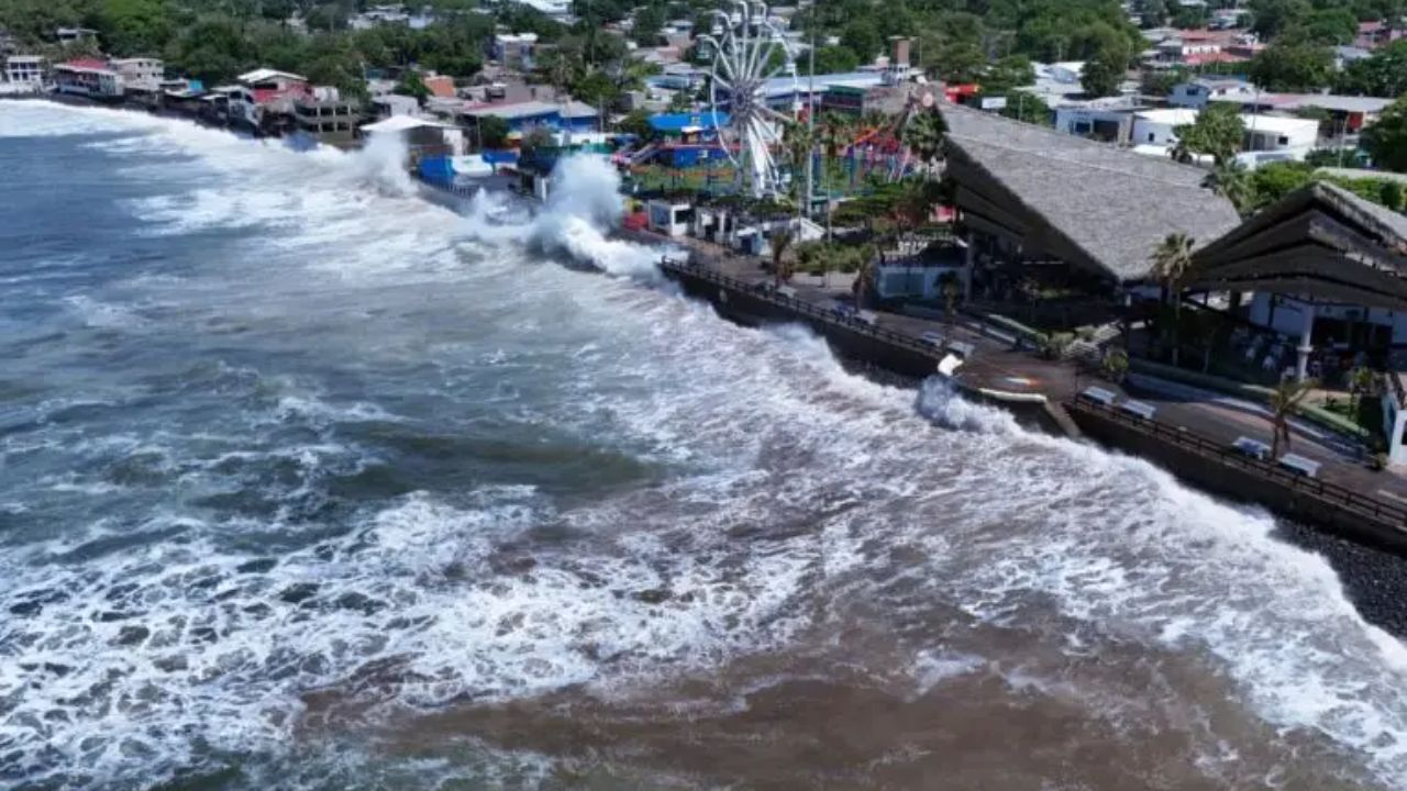
Swells generated by Polo will affect southwestern Mexico over the next few days and spread north along the coast of west-central Mexico toward Baja California Sur on Friday and into the weekend. The hurricane center said those swells are likely to cause life-threatening surf, rip currents, and coastal flooding.
A Storm That Keeps Surprising Forecasters
Polo has been one of the most dramatic storms of the 2026 season. Its winds climbed from 45 mph early Monday to 150 mph about a day later, a pace the hurricane center called "truly remarkable," and CNN reported that it ranked among the fastest intensification rates on record in the eastern Pacific. Hurricane Patricia holds that basin's 24-hour intensification record, set in 2015.
In its latest forecast discussion, the hurricane center said Polo has completed its eyewall replacement cycle, a process in which a new eyewall forms around the old one. Storms often weaken temporarily during such cycles and can restrengthen afterward. Forecasters said some additional near-term strengthening could occur, and the official forecast shows a peak near 175 mph on Thursday morning.
The discussion cautioned that strong hurricanes can undergo intensity swings that are hard to predict, but said there is high confidence that Polo will remain a powerful major hurricane for the next few days. Vertical wind shear is forecast to increase over the hurricane in two to three days, with faster weakening after that.
The Weekend Turn Toward Baja California Sur
The longer-range track is where uncertainty grows. A mid-level ridge over Texas and northern Mexico is expected to steer Polo northwest and west-northwest, away from mainland Mexico, through Friday night. This weekend, an upper-level trough approaching the U.S. West Coast is forecast to weaken that ridge and turn Polo toward the northwest and north, bringing its center toward Baja California Sur.
The hurricane center's five-day forecast shows Polo weakening as it approaches, with winds near 115 mph by Sunday evening and near 90 mph by Monday evening. Forecasters stressed there is still considerable spread among the models in the timing and location of that turn, and impacts can occur outside the forecast cone.
No watches or warnings had been issued for Baja California Sur as of the 9 p.m. CST advisory, but the hurricane center said interests there should monitor Polo's progress. Residents and visitors in Los Cabos, La Paz, and the rest of the state should follow updates closely over the next several days.
Guidance for Travelers and Families
Americans in or traveling to Ixtapa-Zihuatanejo, Lázaro Cárdenas, Manzanillo, the Jalisco coast, or Baja California Sur should follow instructions from Mexican civil protection authorities and their hotels, stay off beaches during high surf, and avoid flooded streams and hillsides. U.S. citizens abroad can enroll in the State Department's Smart Traveler Enrollment Program to receive safety alerts.
Anyone with travel plans to Baja California Sur this weekend should check with airlines about rebooking options and watch for forecast changes. Travel insurance bought after a storm is named often does not cover disruptions from that storm, so review policies before making decisions.
Polo does not pose a direct threat to the United States in the current forecast. Readers should rely on the National Hurricane Center for official information. The next complete advisory was scheduled for 3 a.m. CST Thursday, with an intermediate advisory at midnight.
Related NatureWorldNews Coverage
Hurricane Polo Reaches Category 5 Off Mexico as Tropical Storm Watch Stretches to Manzanillo
What Readers Want to Know
How strong is Hurricane Polo?
As of 9 p.m. CST on September 23, Polo was a Category 5 hurricane with maximum sustained winds near 160 mph and a minimum pressure of 923 millibars.
Where is Polo located?
It was about 130 miles south-southwest of Zihuatanejo and 240 miles south-southeast of Manzanillo, moving northwest near 6 mph.
Is Polo expected to make landfall in mainland Mexico?
The NHC forecast keeps the core offshore of southwestern Mexico, but tropical storm conditions, heavy rain, and dangerous surf are affecting the coast.
What warnings are in effect?
A Tropical Storm Warning covers Tecpan de Galeana to Manzanillo, and a Tropical Storm Watch covers west of Manzanillo to Playa Perula.
Could Polo affect Baja California Sur?
Forecasters expect a turn toward Baja California Sur this weekend, likely as a weakening hurricane, but the timing and track remain uncertain.
Will Polo affect the United States?
Polo does not pose a direct threat to the U.S. in the current forecast. Americans traveling in western Mexico should monitor local guidance.
© 2026 NatureWorldNews.com All rights reserved. Do not reproduce without permission.

















 English (US) ·
  French (CA) ·