

PROTECT YOUR DNA WITH QUANTUM TECHNOLOGY
Orgo-Life the new way to the future Advertising by AdpathwaySo you remember how we always talk about the HIGH being a huge factor in development or lack of tropical development and a steering factor if and when a system develops? So keep that in mind with this discussion today.
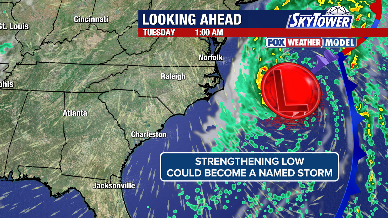
The GFS has been fairly persistent in something forming off the East Coast either down to the N of the Islands or closer in East of Florida on the far left edge of the Huge HIGH in the Atlantic. As always we say over and over until you hate hearing it "watch the tail end of an old front" and yet it often is the main producer of systems in El Nino years that favor close in development off the East or SE Coast far from the Big Bad El Nino that acts like the Big Bad Wolf that is going to blow Little Red Riding Hood away or in this case what may or may not become Cristobal if the GFS is right. That said the EURO is hinting at some sort of development in that same region, though not as strong of course as the always ready to party GFS. Going to show the GFS, but remember it changes on every run in some way, but most have focused on the coast of the Carolinas. It's true this started with the same system sliding along the Florida coast up towards the Carolinas, now it's consistently offshore the Carolinas.

It's the GFS
If some off the AI models were on this...
...I'd pay more attention

Note tho there seems alot off rippling...
.. in that area.

The strip off orange that's angled to the ENE
is moving one way
And the areas to the South are going the other way.
.gif)
IR satellite imagery shows a little "dip"
Again often part of the front moves on out to sea.
And another part hangs back...
.......and sometimes it can spin into a system.
Lots of IFS
.gif)
Remember this is WAY DOWN THE ROAD
I am just showing the current environment.
Interesting little swirl (li'l) near Mona Passage.
I just checked the TWO from NHC
That's an upper level low...as I thought.
but I like confirmation ;)

.gif)
Note center bottom of the loop.
That little swirl, ULL
Dancing in the Mona Passage
And to the NE nose of the High out to the right.
Near PR
Listen getting development in an El Nino Year, a strong El Nino Year is not easy. And, it's usually the random connections of a dead in the water front over very warm water, some swirl moves into the area and helps get things spinning close in. Or cross currents do the trick. There are models that are playing with a distant African Wave but it's still a bit soon for August development in any year and this is NOT any year. So while I may watch it, I'm more concerned with close in development in regions beyond the reach of El Nino. And, close in systems especially close in to the coast have more chances to impact land or make landfall. And, IF something develops the general trend in modeling is the HIGH chooses a bad time to expand and push that system closer to the coast. Which is why we always watch the High.
It's a definite "maybe"
So stay tuned.
We are far from the NHC blinking yet.
Sweet Tropical Dreams,
BobbiStorm
@bobbistorm on X
X mostly weather, elsewhere whatever

















 English (US) ·
  French (CA) ·