

 2 months ago
88
2 months ago
88
PROTECT YOUR DNA WITH QUANTUM TECHNOLOGY
Orgo-Life the new way to the future Advertising by AdpathwayAfter a long stretch of quiet across the tropics, we are now keeping tabs on three areas of disturbed weather.
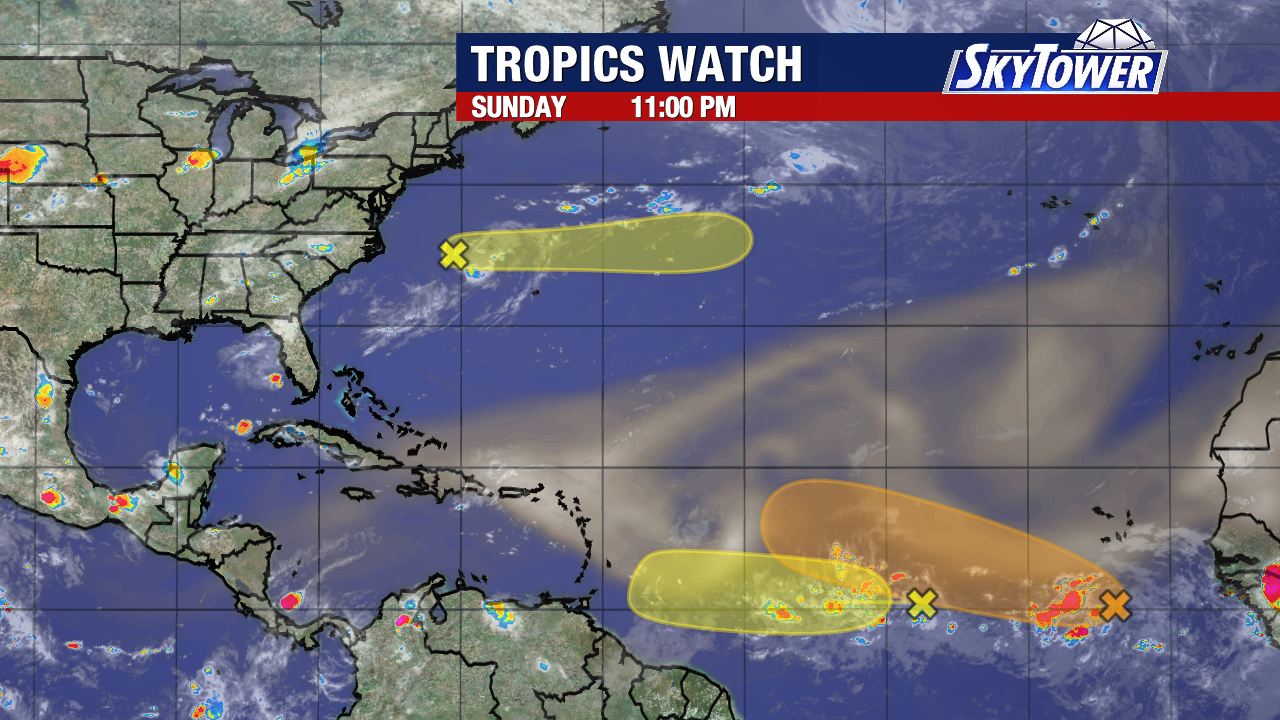
No system poses an immediate threat to Tampa Bay. Each has chances of becoming a tropical depression or tropical storm over the next week.
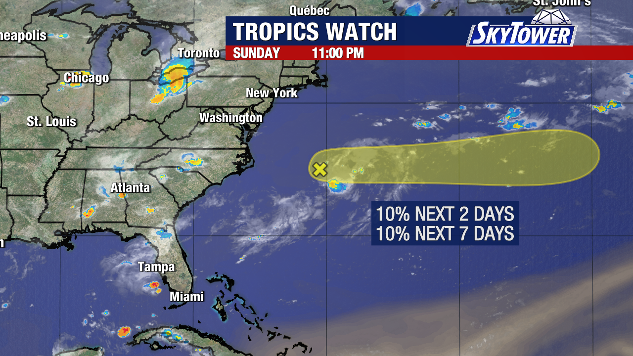
A trough of low pressure will have a small chance to develop as it moves away from the east coast of the United States. This is not expected to be consequential to the U.S. and will travel north of Bermuda into a hostile environment later this week.
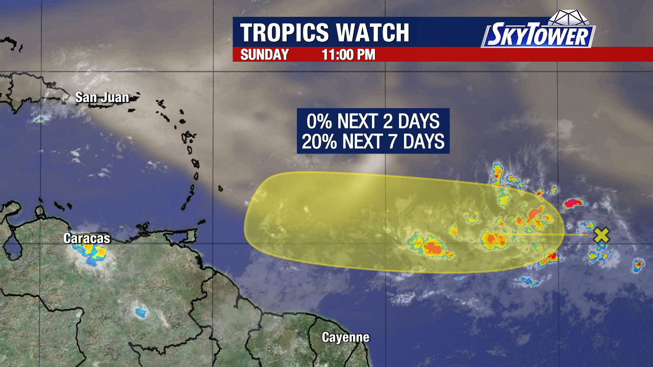
The next disturbance is currently (marked with a yellow X) in the tropical Atlantic and will continue moving west toward the Lesser Antilles through the end of the week. There is considerable disagreement among forecast models on whether this system will ever become a tropical depression. Some models attempt to organize the disturbance, while many others never have it come close to development.
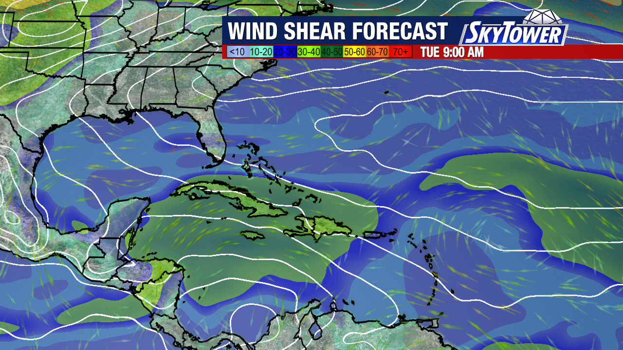
The Caribbean is a particularly hostile environment for tropical development right now, with strong upper-level winds (shown in green) creating significant wind shear. That shear can disrupt thunderstorms and prevent a developing tropical system from organizing. The ongoing El Niño pattern is one factor contributing to the unfavorable upper-level environment across parts of the Caribbean and tropical Atlantic.
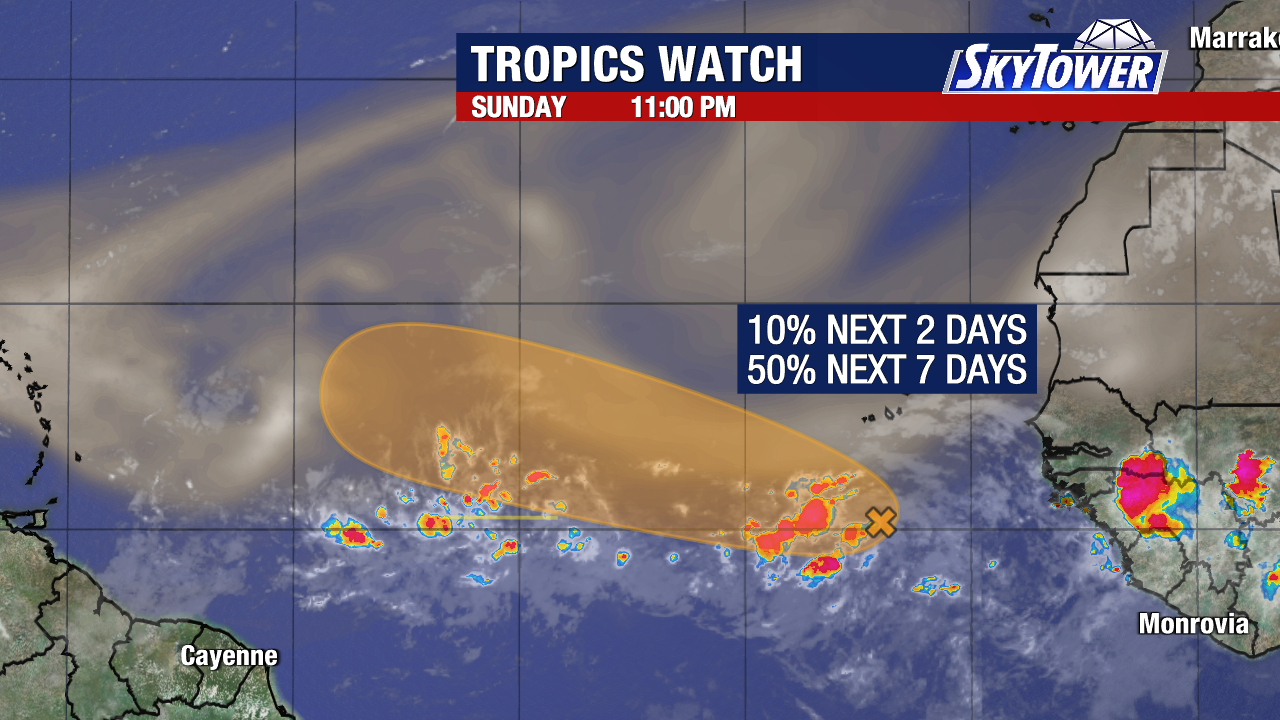
Weather models are slightly more supportive of this wave (shown with an orange X) eventually trying to develop later this week. This is because the system may enter a more favorable environment once it gets farther west of the Cabo Verde Islands. However, there are still plenty of obstacles it must overcome.
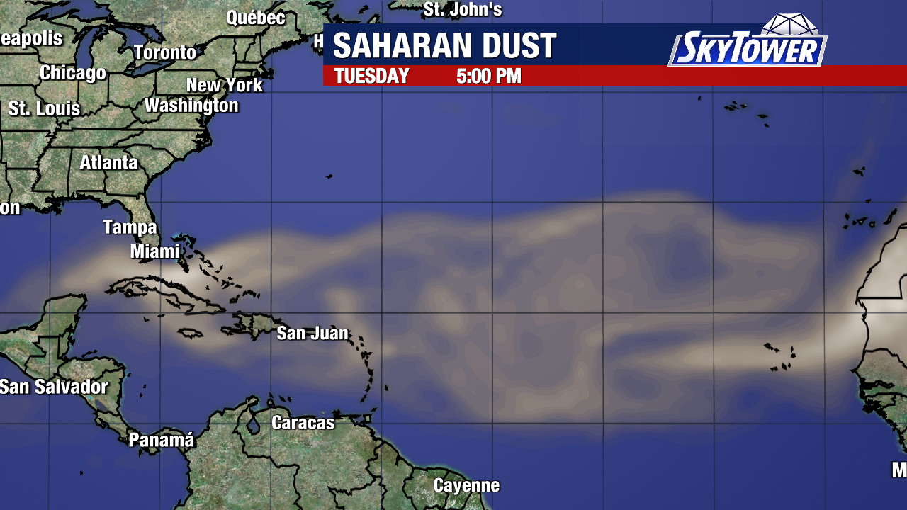
Saharan dust and dry air will be present across portions of the tropical Atlantic, while wind shear also remains elevated across the Main Development Region. Those factors will be working in tandem to try and stop the formation of each disturbance.
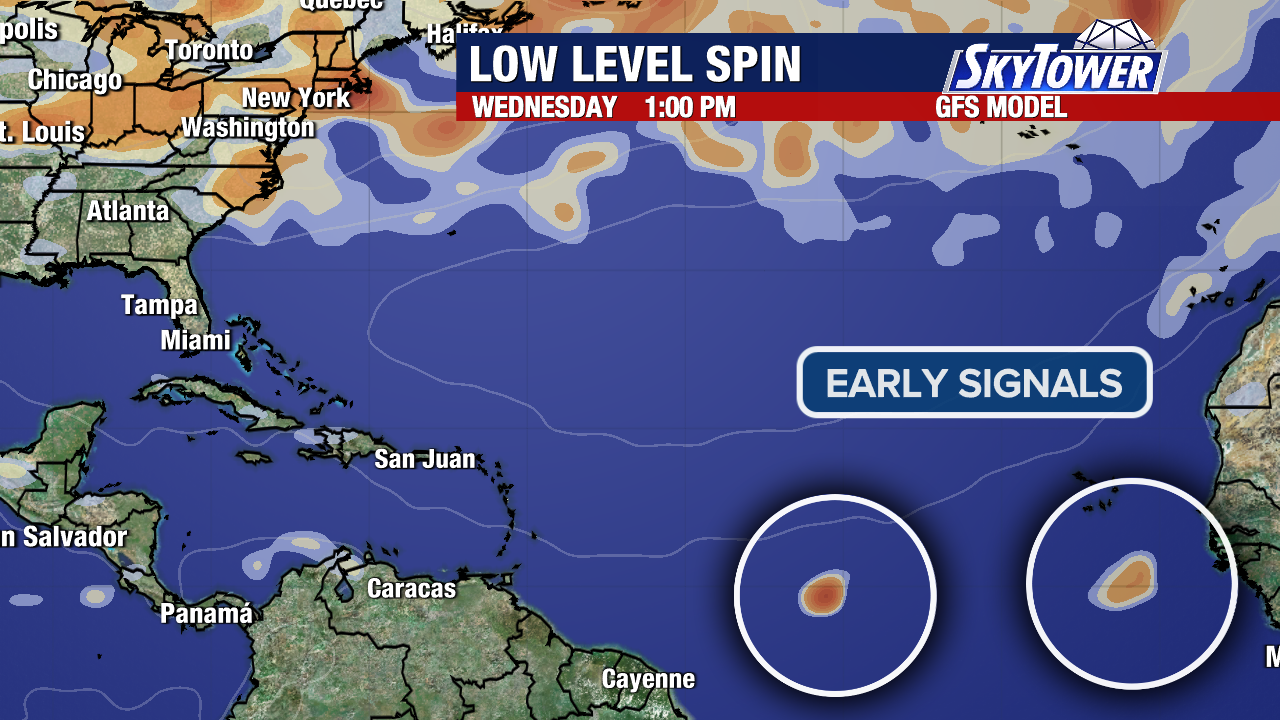
As of now, the majority of weather models that develop the second wave eventually show it being pulled back toward the north before reaching the Caribbean. A weakness in the Bermuda High could allow the system to turn more toward the open Atlantic instead of continuing straight west toward the Caribbean or the United States. Of course, that’s all contingent on the system developing in the first place.
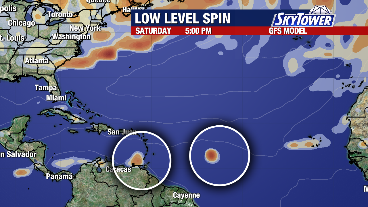
Each tropical wave has a long way to go, and there are still significant environmental obstacles that could prevent either one from developing.
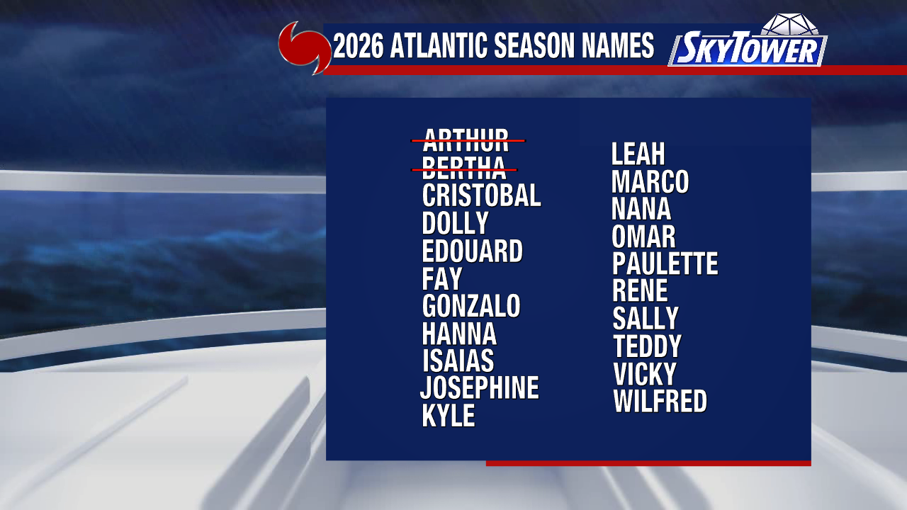
If either system manages to become a named storm, the next name on the 2026 Atlantic list is Cristobal.















 English (US) ·
  French (CA) ·