
PROTECT YOUR DNA WITH QUANTUM TECHNOLOGY
Orgo-Life the new way to the future Advertising by Adpathway
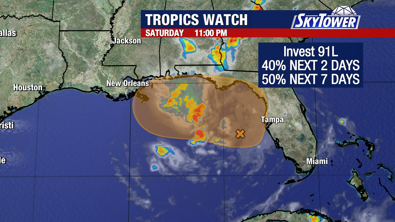
NHC 2 day map.
A dipping, front kind of weak.
I'll take it ...was close to 90 in NC yesterday.
Plume of moisture from EPAC N into Gulf.
Watch the flow below....
.gif)
Our "busy" IR sat shows lots of color..
all crashing into each other!
.gif)
Concentrated consistent convection gets the name.
Otherwise it's lots of convective clutter.
Crashing into eachother.

Zooming in you can see...
Strong convection in the EPAC close in
In the BOC we have a curvy dark C there.
It's an upper level low.
Always good to watch....fun but good.
Sometimes they can develop.
And more so..
they enhance development of convection nearby.
They are not BIG players.
But big players behind the scenes.

This shows a bit of red in BOC
And down below a big blob.
2 parts of one puzzle.
Ironically that is NOT the area that is being watched in the EPAC for development, that region is further out in a flattened zone of clusters of convection and small kinks in the wind flow. Note early development further out is consistent with a developing El Nino where water temps are warmer in this region. Also, it's moving to the West not threatening the EPAC's beautiful coastline.
Earthnull shows the wind flow.

Not much there. Changing the parameters...
...you smoke out other layers of the atmosphere.

To the North you have the diving air off East Coast.
Out West you have an Omega Block
This creates wind shear ....
...and a too busy atmosphere.
Zooming in you see our ULL in the BOC

Just explaning not expecting anything.

Out in the Pacific we have a 60% chance of formation.
Development possible in the next 7 days.
As for the Atlantic... nada...nothing for now.
But NHC did highlight the ULL on X.
Strong winds, stormy weather.

Have a wonderful weekend!
Should you see Post Memorial Day Sales...
Grab some Hurricane Supplies at discounts.
Stash them away....

Remember there's El Nino building to the West, there's SAL moving in from the East. Fronts are still dipping down from the North and then going flat. And, we have a feisty Upper Level Low in the Bay of Campeache a favorable area for development in June. And, there are impulses of stormy weather there currently that could be tickled some by the ULL in this configuration that is enhancing convection. Just stuff to watch. For now just stuff. Down the road in 3 days, maybe more than just "stuff" but an area to watch. For now there's a a lot of wind shear everywhere, but if that changes it may be something to pay attention to in a few days. Enjoy the weekend!
Sweet Tropical Dreams,
BobbiStorm


 English (US) ·
  French (CA) ·